Introduction
Developing large buildings in the UK is complicated. Space is a finite resource, securing funding isn’t easy and then there’s the matter of getting permission.
Along the way, there are many potential impacts that need to be identified and addressed. Some of these are relatively obvious – for example visual impact – whereas some are more esoteric – such as the potential effect on microwave link networks in the area.
This article presents a short overview of the technical issues that Pager Power deals with on a regular basis. It also gives some pointers on how to ensure your project doesn’t get derailed by these potential problems.
Nearby Airports
The problem
Tall buildings can present a safety risk to airports. Broadly, the concerns fall into two categories:
- Collision risk.
- Impact on radar and other navigation aids (discussed in the next section).
Collision risk can be minimised by assessing structures against Obstacle Limitation Surfaces. These are nationally and internationally defined imaginary surfaces that should not be infringed by structures, including buildings.
Note that some airports, including London City Airport, can implement their own safeguarding rules in addition to or in place of the ‘standard’ ones.
Note also that helicopter routes within a few kilometres of a proposed tall building may require assessment with regard to collision risk.
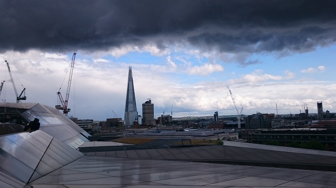
 Figure 1: The Shard – the tallest building in the United Kingdom
What to do
- Identify the airports within ~20 km of any proposed tall building.
- Identify any helicopter routes within ~5 km of any proposed tall building.
- Assess the Obstacle Limitation Surfaces and any other safeguarding criteria in accordance with the relevant guidance.
- Consult with the airport(s) to establish their concerns and/or requirements.
Common solutions
- Ensuring proposed buildings do not infringe Obstacle Limitation Surfaces.
- Marking potential obstructions with aviation lighting.
Radar
The problem
The two kinds of radar that are the most common for air navigation purposes are:
- Primary Surveillance Radar (PSR) – this emits a radio pulse in all directions and analyses the echo to identify the range and bearing of aeroplanes.
- Secondary Surveillance Radar (SSR) – this emits a radio pulse in all directions that is received by a transponder on board an aircraft. A reply signal is then sent back to the radar receiver containing specific information about the aircraft.
Both radar types can affected by tall buildings. Principally, the impact occurs due to the building acting as a physical blocker of the signal, or reflecting the radar signal in an unwanted direction.
Note that airports utilise a range of other navigation aids that can also be affected by large structures such as buildings. This includes Instrument Landing Systems (ILS), Distance Measuring Equipment (DME), VHF Omni Range (VOR) and others. The individual considerations for each of these are not discussed within this article, but such systems may warrant assessment under particular circumstances. Guidance has been produced by the UK Civil Aviation Authority and the International Civil Aviation Authority in this regard (see the references section for more information).
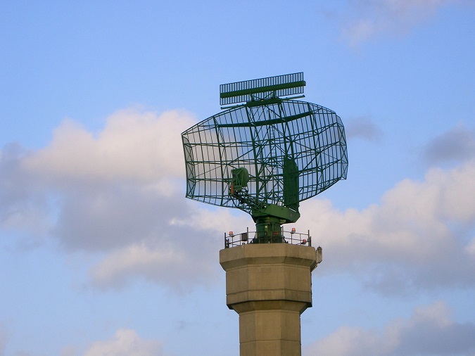
 Figure 2: A co-located PSR and SSR
What to do
- Identify airport radar within ~30 km of any proposed tall building.
- Identify any en-route radar that may have line of sight to the proposed development – even at large distances.
- Assess the potential technical and operational impact of the proposed building.
- Consult with the radar operator(s) establish their concerns and/or requirements.
Common solutions
- Demonstrating that there will be a minimal technical/operational impact on the radar.
- Radar mitigation solutions that involve programming in the location of a known reflector.
TV Interference
The problem
Terrestrial television is broadcast by ground-based transmitters to TV aerials, typically located on rooftops. There are two ways a tall building can impact on terrestrial television reception:
- By blocking the transmitted signal in the shadow of the building.
- By reflecting the signal in an unwanted direction.
In practice, it is the blocking of the signal in the building’s shadow that is the most likely interference source when it comes to terrestrial TV. Note that Ofcom has also produced guidance pertaining to this issue, which Pager Power has summarised in Part 1 and Part 2 of our technical reviews.
Interference to satellite television due to a tall building is less common, but possible. In the UK, the interference zone is typically located to the north of the building within a few hundred metres, but this varies based on the building height, attitude and the elevation angle to the satellite itself.
Guidance from Ofcom advises technical assessment of potential TV interference out to 5 km. This is a good approach to take, in practice complaints are the most likely within 1 km of a new building.
What to do
- Identify the transmitter(s) serving the area surrounding the proposed building.
- Model the potential interference areas associated with the proposed building.
- Conduct a baseline survey within the interference areas to record the pre-existing coverage quality.
- Conduct a post-construction survey within the interference areas to record the change coverage quality.
Common solutions
- Re-directing affected TV aerials to an alternative transmitter.
- Provision of an alternative source of TV such as satellite.
Wireless Communications
The problem
Many services we rely on day-to-day are provided by wireless radio networks. Such systems are utilised by mobile phone network providers, emergency services and utility companies. In general terms, these systems typically rely on:
- A direct radio connection between fixed points.
- A radio connection between a broadcaster and mobile receivers within an area.
There are two ways a tall building can impact on wireless radio systems:
- By blocking the transmitted signal in the shadow of the building.
- By reflecting the signal in an unwanted direction.
The recommended safeguarding approach is dependent on the system type. In general, fixed links are safeguarded by consideration of Fresnel Zones. Broadcast systems may require a methodology that is closer to the approach taken for TV interference.
What to do
- Identify the wireless systems that operate within ~5km of the building.
- Carry out a safeguarding assessment to establish the technical impact of the proposed building.
- Consult with the system operator as appropriate.
Common solutions
- Ensuring safeguarded zones are not infringed.
- Re-directing an affected link.
- Provision of an alternative system (for example a copper cable to replace a wireless link).
Glint and Glare
The problem
Tall buildings can comprise a large surface area of flat solar reflectors. The most common example is windows, which can produce solar glare towards an observer. In some cases, buildings can comprise other reflective surfaces which can present a concern.
This issue is very common for solar photovoltaic developments. However, it can be a concern for building developers, particularly if the proposed building is adjacent to a railway line. This is because Network Rail is known to raise solar glare as a safety issue, based on potential effects for train drivers and signals. It is possible for solar glare concerns to be raised for nearby dwellings and road traffic.
Modelling of the proposed reflective surfaces relative to the path of the Sun throughout the year allows the potential effects to be quantified.
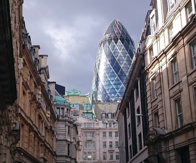
 Figure 3: 30 St Mary Axe – “The Gherkin” – largely covered in glass panels
What to do
- Identify any railway lines within ~100 metres of the proposed development.
- Model the reflections for sensitive receptors.
- Evaluate the likely effect of potential reflections.
- Consult with the relevant stakeholders as appropriate.
Common solutions
- Demonstrating that potential effects will be insignificant.
- Provision of screening for potentially affected receptors e.g. signal hoods for incandescent bulb railway signals.
What to Avoid
It is highly inadvisable to adopt a ‘wait and see’ approach to the issues above. This is partly because issues that come into focus late can lead to costly delays in the overall progress of the project. Perhaps more importantly, some mitigation options require changes at the design stage (such as limiting the height of some or all of the building). This may not be feasible at a project’s later stage, therefore it’s better to proactively uncover any hindrances at the design stage.
References
- UK Civil Aviation Authority, 2014, CAP 168 Licensing of Aerodromes (Version 10).
- UK Civil Aviation Authority (2004), Safeguarded and Obstacle Limitation Surfaces – London City Airport.
- United Kingdom AIP (2014), En-Route Information 5 Navigation Warnings (Section 5.1).
- UK Civil Aviation Authority (2006), CAP 738 – Safeguarding of Aerodromes (Version 2).
- ICAO (2009), EUR Doc 015 European Guidance Material on Managing Building Restricted Areas (second edition).
- Ofcom (2009), Tall structures and their impact on broadcast and other wireless services
- Manning, T. (1999), Microwave Radio Transmission Design Guide, Artech House Books
