Digital Elevation Models (DEM)
")
When using digital elevation models data we often come up against terms like DEM, DTM, and DSM. Often they can be confusing and also misinterpreted to mean the same thing. In this article we attempt to quickly explain what each terms means and hopefully help clarify some key points.
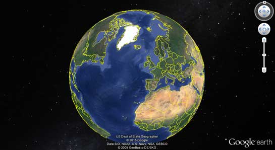 Figure 1 Google Earth is using DEM to provide the elevation of the Earth’s Surface
Digital Elevation Models (DEM)
A Digital Elevation Model (DEM) is a representation of the elevation of the Earth’s surface above a certain datum (e.g. mean sea level) in digital form. This is achieved taking elevation measurements at regular (e.g. every 50 metres) or irregular spaced points (e.g. every 3 arc seconds) over the Earth’s surface.
There are various acronyms used to describe digital elevation models. Two very popular ones are Digital Terrain Model (DTM) and Digital Surface Model (DSM).
Digital Terrain Model (DTM)
A DTM is a DEM that represents the elevation of the bare earth without taking into account any overground features (e.g. trees, buildings). An example of a popular DTM in the UK is the Ordnance Survey’s 1:50,000 Panorama which provides bare earth heights at 50m regular spacing points.
Digital Surface Model (DSM)
A DSM is a DEM that represents the elevation of the surface a remote sensing system will first meet (i.e. when aerial photography is undertaken the top of a building, forest, etc.). Thus, the resulting DSM includes the elevation of the bare earth terrain plus the natural (e.g. trees, shrubs) and man-made features (e.g. buildings).
An example of a DSM is the NASA’s Shuttle Radar Topography Mapping (SRTM) mission, which covered about 80% of all the Earth’s land (approximately 3 arc seconds ≈ 90m spacing irregular points).
DTM vs DSM
In the diagram below the black line represents an elevation profile of bare earth (DTM). The red dotted line represents an elevation profile of bare earth + overground features such as buildings, trees and shrub (DSM).
 and DSM (red line)")
| Digital Surface Model | ||
| Digital Terrain Model | ||
Height of Vegetation
It is useful to know the height of vegetation so that its effects on radar and radio coverage can be predicted. This presents a number of challenges because:
- The height of vegetation varies
- Vegetation blocks radio signals more when in leaf and less when not in leaf
- The thin top part of a tree attenuates signals less than the lower bushier parts of a tree
This is further complicated by the fact that DSM data is gathered using radio signals reflected off the surface which includes vegetation. DSM data gathered in summer is likely to register vegetation as being higher than if the same data were to be gathered in winter because the denser summer vegetation reflects radio signals back from a higher level.
In practice DSM data does include trees but often only part of their height. For example a woodland having a maximum height above ground of 12 metres might appear to have a height of just 6 metres in a DSM dataset. It is therefore important to treat DSM data for wooded areas with caution.
Where we use DEMs
DEMs are used in all sorts of applications ranging from mobile phone apps, to Google Earth, satellite navigation applications to civil engineering and radio planning.
At Pager Power we use DEMs for our day to day analysis requirements. A few examples follow (the list is not exhaustive):
- Effects of wind turbines on radar; e.g. Radar Line of Sight Assessment
- Effects of wind turbines on radio telecommunications (e.g. Television Broadcasting interference);
- Effects of wind turbines on flying safety in the vicinity of airports
- Large structures (e.g. tall buildings) in the vicinity of airports
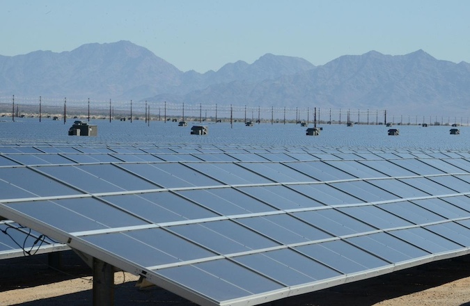
- Effects of solar photovoltaic panels on aviation, radar and ground based receptors (e.g. trains, road users, residents, etc.)
- Effects of large buildings on radar
Where do you use DEMs? Let us know by leaving a comment below.
Image accreditation: US Dept of State Geographer, © 2015 Google, Data SIO, NOAA, U.S. Navy, NGA, GEBCO, © 2009 GeoBasis-DE/BKG, image sourced from Google Earth.
post contents
About the Author: Mike
Latest News
US Continues to Build Out Solar Capacity
Earlier this month, the Solar Energy Industries Association (SEIA) released [...]
China’s Airborne Wind Turbines
In early 2026, China successfully developed an airborne wind turbine [...]
Shadow Flicker Assessments for Wind Turbines: A 2026 Update
Shadow flicker is the effect of rotating turbine blades, causing [...]


