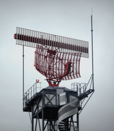
 Most of you reading this article will be familiar with what is required when planning a wind development. So you don’t need us to tell you that impact on radar is one of the many areas that it is essential to assess.
However what you might not know is that we have an online Radar Line of Sight Assessment tool that can help make evaluating radar impact a little bit less of a headache. And it can be useful to you in four different ways…
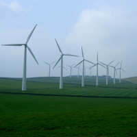
1. Improve your site selection decisions by screening preliminary turbine locations for visibility to specific radar, to find the most shielded spot.
So you have a few carefully selected locations in mind which might be suitable for your wind project. So why not check them all before settling on one? The results can be used to make more informed judgements over the best places to put the wind turbines. We’ve designed the assessment so you can evaluate as many location coordinates as you like, for +£20 each.
It’s much cheaper than running a separate report further down the line. Again you will need some idea of the turbine model that you are planning on installing.
(Another great complete aviation site screening tool is our online Aviation Risk Assessment.)
2. Discover the radar visibility of a wind development near to your project.
“I have a radar objection from <insert name>, but there’s an operational wind development close by, so why are they objecting to mine?”
This is something that we encounter a lot, and our first point of analysis is to run a Radar Line of Sight Assessment on the nearby wind development to help realise why that project got consented. If you know the wind turbine specifications, you could do that too. Once you understand that, it can help implement a more informed mitigation case.
3. Gain a better understanding on an aviation stakeholder’s objection.
Use the Radar Line of Sight Assessment to review why the stakeholder objected. If you know how much of your turbine is visible to their radar then you can make well informed decisions on how to proceed with your project.
If you order the assessment with an Expert Commentary, then you will also get recommendations on moving forward from Pager Power. These are founded from over 15 years of industry experience.
4. Save your time by verifying whether the turbine locations you’ve chosen will be visible to a radar.
This is perhaps the most obvious use of the assessment. After you have carefully evaluated all constraints to choose locations for your turbines, you can check whether a known radar can “see” your wind project.
Rather than spending your time studying terrain on Google Earth, and making a best guess. Just input the coordinates as well as height wind turbine into the Pager Power Online system, choose the radar and let us do the hard work for you. Our accurate model will even include Earth curvature and refraction effects.
So could you name all four? If you have any questions about our online assessments, or what we can do to help with your wind farm radar interference issue, feel free to get in touch with us +44 (0) 1787 319001.


