Who Has Decision-Making Power on Radar and Mitigation During Planning?
Last Updated: October 14, 2026
Share:
In any planning application, the final decision lies with the planning authority to decide if a project receives permission or is denied. For smaller projects, this is usually the local planning authority. For larger projects, deciding authority is typically vested in the national government.
This article outlines the roles of different stakeholders involved in projects where radar impacts are possible, who makes which decisions, and what to expect from each party.
Which Projects Can Impact Radar?
Radar impacts typically come about from either wind turbines or new buildings. Further from a radar, usually only tall buildings are of concern. While buildings close to radar can present impacts even at short heights.
This article is therefore concerned with radar impacts from wind turbines and buildings.
Other types of projects, such as solar farms, do not typically present radar issues. Should a radar operator raise concerns, specialist technical advice should be sought.
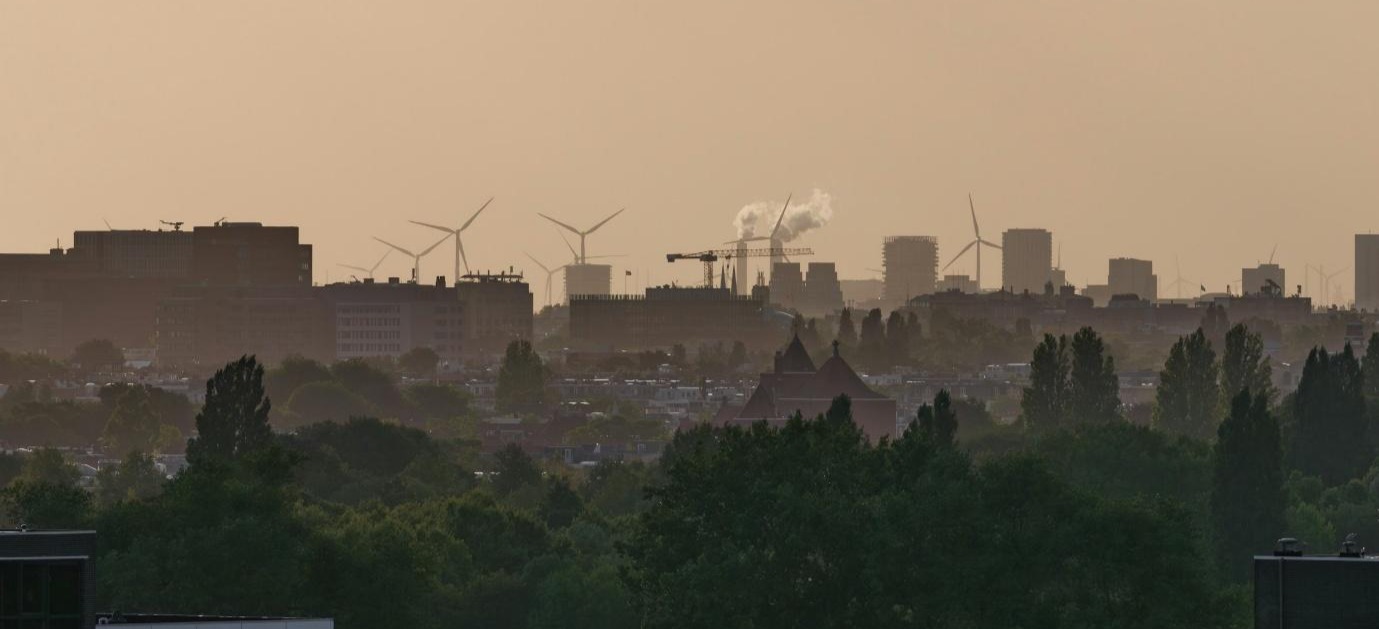
[1] Wind turbines and buildings are typically considered for radar impact.
Which Stakeholders Tend to be Involved?
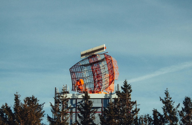
The UK has a variety of radar systems for both civil and military purposes. Radar are primarily used for aviation but are also employed for monitoring weather and space.
The following stakeholders are likely to review proposals for new buildings and turbines near their installations:
- NATS (formally National Air Traffic Services)
- Who operate a network of “en-route” radar to monitor aircraft transiting between airports, and in and out of UK airspace
- The Ministry of Defence
- Who operate a network of air traffic control radar, and air defence radar, to monitor military traffic and watch for enemy aircraft
- Local airports
- Which may be equipped with their own radar for monitoring local traffic
- The MET Office
- Who operate a network of weather radar to monitor and predict weather patterns across the country
- Local observatories
- Who may operate sensitive space radar monitoring for emissions of radio waves from space
The distances at which a stakeholder may take an interest in an application vary. Some organisations will be statutory consultees. An aviation consultant will be able to identify the key stakeholders for a specific project upon reviewing the location and project description.
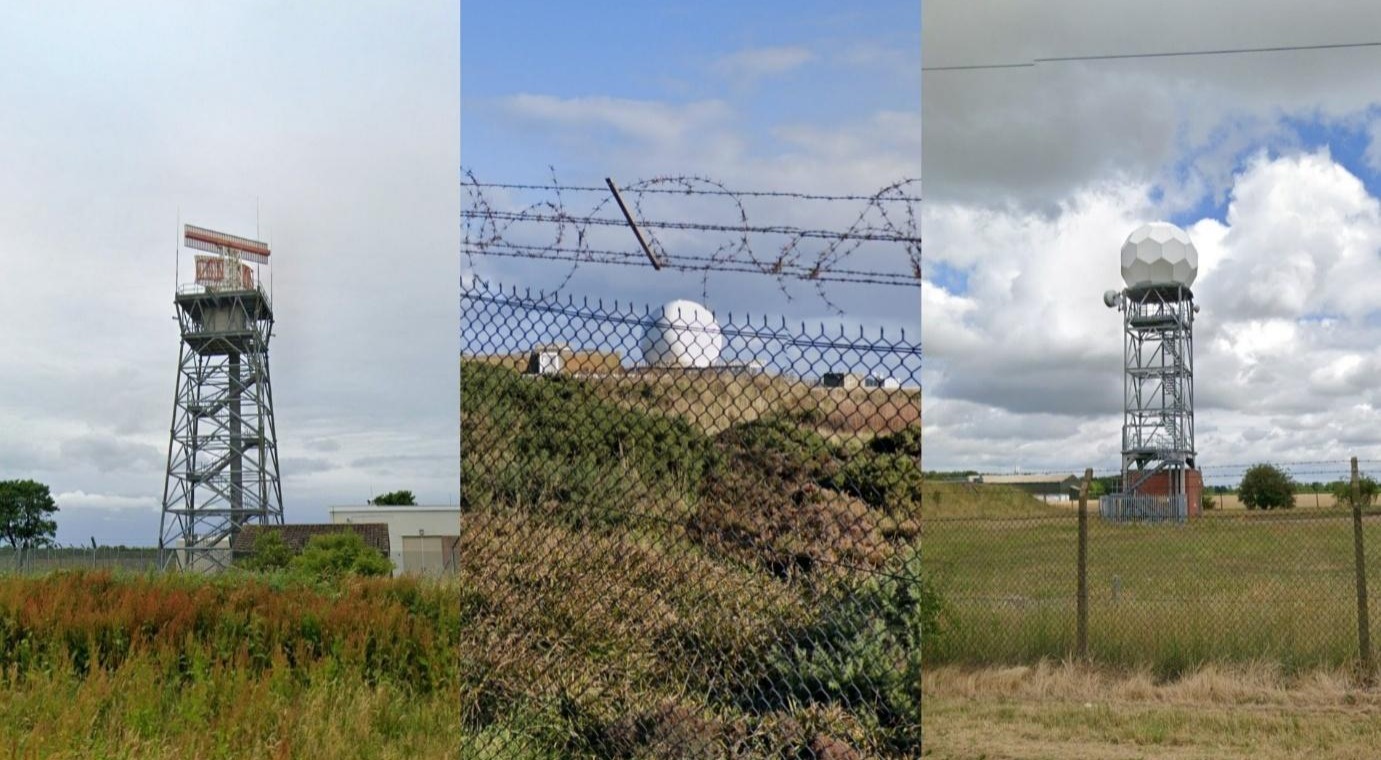
[2] A civil aviation radar (left), a military radar (centre), and a weather radar (right).
What Can The Planning Authority Do With an Objection?
Radar impact usually relates to very important issues, such as national defence, aviation safeguarding, and weather monitoring. As such, a planning authority is likely to give substantial weight to an objection from a radar operator.
It is worth noting that a planning authority is not obligated to follow the recommendation of a stakeholder. The ultimate decision-making power does not belong to the stakeholder, but to the planning authority. However, if an objection has been raised, the authority is expected to provide a robust justification for any decision which goes against their recommendation where safety or defence could be affected.
The authority is therefore most likely to request that the applicant engage with the radar operator to discuss impacts and determine if mitigation can be implemented and agree this prior to returning to the authority.
If and when the operator is satisfied that mitigation has been agreed, or that all options have been explored and no solution found, they will provide an updated position to the planning authority to inform their decision-making process.
How Pager Power Assists with Radar Impact
Pager Power works with project developers and radar operators to assess potential impacts, explore mitigation options, and facilitate engagement between parties to assist the right projects to be built in the right places.
Pager Power has over 20 years of experience in assessing radar impact. If your project is facing radar objections, or a radar feasibility check is needed for your site, reach out for some specialist advice.
For more information about what we do, please get in touch.
Image Attributions:
Ben Kupke (Feb 2025). Available at: https://unsplash.com/photos/a-tall-tower-with-a-red-and-white-structure-on-top-of-it-l5lrW6iG07w?utm_source=unsplash&utm_medium=referral&utm_content=creditShareLink (Accessed 12 October 2026)
Image 1: Haberdoedas (Oct. 2025). Available at: https://unsplash.com/photos/city-skyline-with-buildings-and-wind-turbines-at-dusk-bGvK-OmWv20?utm_source=unsplash&utm_medium=referral&utm_content=creditShareLink (Accessed 12 October 2026)
Image 2: Google Earth, various dates. Available at: https://earth.google.com/web/?hl=en-GB (Accessed 12 October 2026)
post contents
About the Author: Phillip Charhill