How do Wind Turbines Affect Met Radar and What Constitutes a Significant Impact?
There are different types of radar that can be affected by wind developments. Most often, impacted radar are situated at airports, however, weather radar can also be affected. The data collected from weather radar is used for many different purposes. The most common is to ensure you are prepared for the conditions in the day and week ahead, but it is also used more strategically and has an important role in determining connected weather events. These include, but are not limited to:
- Aviation safety – from flight planning to in-flight situational awareness. Knowing what the weather is doing in the various stages of flight plays a key role in maintaining aviation safety.
- Defence operations – the military need to be aware of the weather conditions to plan their operations appropriately, and is commonly linked to aviation, as above.
- Flood forecasting and emergency response – precipitation and thawing events can lead to flooding, which may not be at the location where it occurs. This needs to be carefully monitored, especially in higher-risk areas.
Met radar scan at multiple elevation angles to build a 3D picture of the atmosphere, which assists the radar in identifying precipitation transitions and vertical weather structure. This understanding improves rainfall accuracy and flood predictions.
The Met Office prioritises taking readings of weather conditions at lower elevations scans because these results are most indicative of the weather conditions on the ground and thus provide the best understanding of surface conditions, e.g. rainfall intensity. Therefore, the lowest Met radar scanning angle of 0.5° above the horizontal is very critical, however the radar’s beams rise with distance due to the Earth’s curvature, meaning that multiple Met radar across the UK are required to provide suitable low-level coverage.
Low scanning angles and multiple elevation scans are imperative to the functionality of Met radar. However, it does increase the likelihood of wind developments affecting the operation of these radar, particularly when they are located in close proximity.
Shadowing
Wind turbines block/attenuate radar beams causing ‘shadows’ which can be visible on the radar coverage mapping. In practice, this can cause the following:
- Loss of radar coverage behind the turbines
- Potentially a significant reduction in the maximum effective range of the radar – this is particularly pertinent considering the lowest scan angle of 0.5°
In a worst-case scenario, a wind development could block all scanning angles utilised by the radar. This is particularly challenging in sensitive areas e.g. where flood risks are greater.
Clutter, False, Returns, and Reflections
Wind turbines reflect radar signals, which can cause false precipitation signals. Clutter does not only appear at the radar location. Due to reflections and side lobes in the radar’s beam, it can show ‘wind turbines’ in locations they are not through detections of these side lobe or reflected signals. This signal is then received at a time when the radar is positioned away from the wind turbines, and these are then falsely plotted in the direction the radar is facing at the time the beam is sent. The clutter area then, is larger than the footprint of the wind turbine. Clutter is generally more manageable than shadowing, however, the two generally occur concurrently.
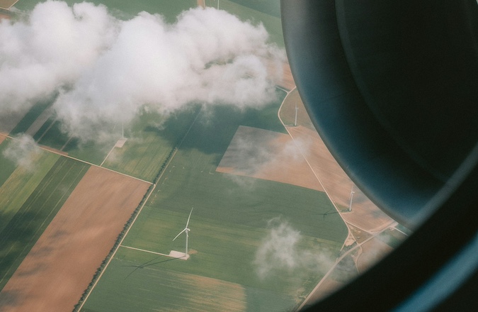
Given the increasing size of onshore wind turbines, which are now seeing tip heights up to 200m and more, and the removal of the onshore wind ban in England, impacts on Met radar are likely to become more common. This increase in size and proliferation could also see impacts from wind turbines extend beyond the 20km safeguarded area, especially when located in more sensitive locations.
How Can we Help?
Pager Power can assist in understanding the likelihood of turbines impacting Met radar, and consult with the Met office to discuss potential mitigation solutions. Get in touch for further discussions about the changing landscape of aviation and radar and how we can help.
Image accreditation: Geograph Britain and Ireland (2018) from Wikimedia Commons. Last accessed on 19 May 2026. Available at: https://commons.wikimedia.org/wiki/File:Met_Office_weather_radar_beacon_-_geograph.org.uk_-_5780991.jpg
post contents
About the Author: Hannah Lucey
Latest News
Onward 2030 Work Package 3: The Future of Wind Mitigation
Onward 2030 Work Package 3 (WP3) has been produced with [...]
What is Electronic Conspicuity, and How Could it Unlock Onshore Wind?
Electronic Conspicuity (or EC) is a term used to describe [...]
What Data Do Solar Glare Consultants Need Before They Can Model The Impact?
For any project involving solar panels, or any other potentially [...]


