Albert Island, Royal Docks, London

In late 2017, Pager Power was engaged by London and Regional Properties to provide aviation planning expertise with respect to the re-development project at Albert Island in East London, England. London and Regional Properties was then appointed as the Greater London Authority’s partner to regenerate Albert Island in March 2018.
Albert Island is immediately adjacent and in line with the runway at London City Airport and therefore it was critical that safeguarding of the airport was considered within the proposed development plans. The development area also resides within the Public Safety Zone (PSZ) associated with the airport, as well as having runway approach lighting physically located on Albert Island itself. Pager Power’s role was therefore to understand, assess and manage the aviation, PSZ and lighting constraints for the site so that the plans for the development could be appropriately designed. This required Pager Power to coordinate closely with both the airport and the developer to ensure the aviation safety requirements were met within the design parameters in line with the required programme.
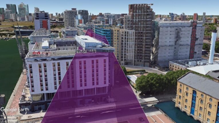
Figure 1: Google Earth image of the Albert Island Development red line boundary relative to London City Airport.
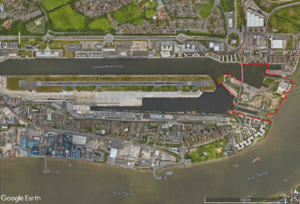
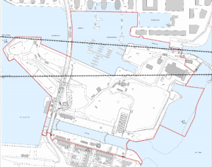
Figure 2: Albert Island Development red line boundary.
Background
Albert Island is a new, sustainable development project in the Royal Docks and it intends to build on the Royal Docks’ formidable strengths in terms of geography, history and people.
Albert Island is located immediately to the east of City Airport, an area of the capital that is undergoing an exciting transformation as part of ambitious regeneration plans, recently announced by the Mayor of London and Mayor of Newham. Over £300 million pounds of investment has been committed over the next five years to help unlock the area’s extraordinary potential including considerable investment in transport infrastructure, arts and culture, digital connectivity, business growth and more.
The 25-acre Albert Island site, owned by the Mayor of London, is a vital part of the regeneration of the Royal Docks. In March 2018 London and Regional were awarded the contract to redevelop the site.
Working in partnership with the local community and key stakeholders, the aim is to create a thriving and sustainable commercial, educational and innovation hub on the Thames and to provide a creative boost to the river environment and economy. We hope Albert Island will flourish within the Royal Docks Enterprise Zone in the years to come.
London and Regional Properties were supported by a number of specialist consultants and planners to bring forward the scheme which had a number of niche and complex planning issues to overcome.
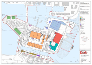
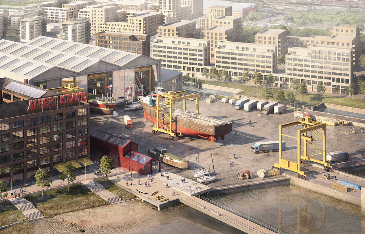
Figure 3 shows the site layout plan for the Albert Island development.
The Challenge
The site is located less than 50m from London City Airport’s runway at its nearest point and therefore consideration of the airport’s operations was crucial when considering the design of the Albert Island Development.
Figure 4 shows the proximity of the development to London City Airport.
The northern section of the development area is also located within PSZ. The runway approach lights for runway 27 are also present within the PSZ.
The key aspects that needed to be considered were the heights of the proposed buildings across the site, as well as the usage of the land and building types for the area present within the PSZ. The first step was to identify all possible constraints for the site. To do this, Pager Power produced an Aviation Risk Assessment which detailed all possible aviation constraints for the site. This report was then presented to the London City Airport in a meeting, where each issue was discussed in turn, and the list of constraints was narrowed to the most significant. These included:
- Building heights and the Obstacle Limitation Surfaces;
- Potential impact upon navigation aids;
- Safeguarding of the runway approach lighting;
- Glint and Glare from surfaces capable of producing specular reflections;
- Crane usage during construction;
- The possible impact upon Instrument Flight Procedures (IFPs)
The presence of the PSZ and application of the associated guidance was a local planning authority issue which was discussed outside of the consultation with the airport.
Crane usage and the possible impact upon the IFPs were considered a post-consent issue and were to be considered further down the project timeline.
Each of the remaining constraints identified above is discussed in the following section.
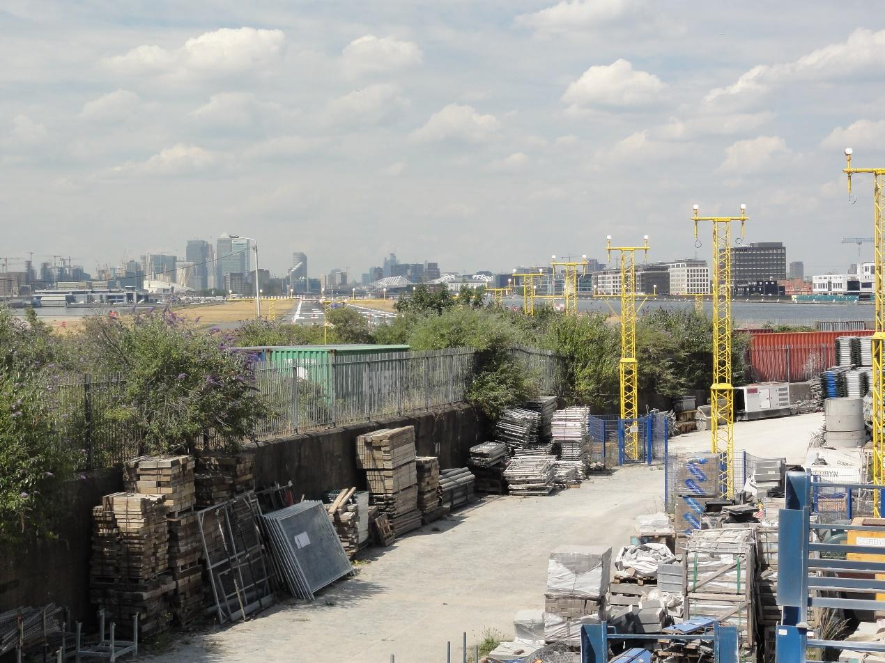
Figure 5 shows an Artist’s impression of the proposed boatyard.
The Process
Building heights and the Obstacle Limitation Surfaces
Obstacle Limitation Surfaces (OLS) are imaginary surfaces which exist around an airport to safeguard against a potential collision risk. Due to the unique position of the London City Airport within the city of London, the airport has its own specific OLS criteria which needed to be understood. To add a further complication, the runway details on which the OLS criteria are based changed very close to the planning application being decided.
Potential impact upon navigation aids
The physical presence of the buildings have the potential to act as a physical obstruction to the transmitted signals from the on-airport navigation aids (and possibly even signals from the approaching aircraft), which could affect their accuracy. The potential to impact upon the operation of the navigation aids at London City Airport was therefore considered a key risk. It was identified that possible interference to the Instrument Landing System for runway 27 was the primary concern for the project. The ILS consists of a localiser and glide path, which are used by aircraft to establish their 3D position on the approach path. Pager Power therefore commissioned a detailed navigation aid impact assessment to investigate whether significant interference was possible.
Safeguarding of the runway approach lighting
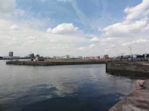
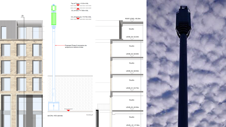
The runway approach lighting for runway 27 is present to the north of Albert Island and exists within an already constrained area consisting of the take-off climb and approach surfaces (from the OLS), as well as the PSZ. Figure 6 below shows the approach lighting present on Albert Island, with the runway visible in the background.
Assessment of the safeguarded area surrounding the approach lighting was therefore required to ensure the approach lights would remain visible and clear to approaching pilots.
Glint and Glare from surfaces capable of producing specular reflections
Considering the proximity to London City Airport, specular reflections were a potential risk to the pilots of aircraft on approach as well as the existing visual ATC Tower and the new virtual ATC tower which had recently been installed. A glint and glare assessment was therefore completed, as well as more general advice being provided to the architects.
The PSZ
The PSZ covers the majority of the spit head as well as a section of the boatyard area. There are strict rules on what can and can’t be located within a PSZ, with the general rule to decrease the number of people that could possibly congregate in the PSZ over time. The guidance therefore needed to be fully understood to ensure the development proposed within the PSZ was in keeping with the guidance.
The Solution
Building heights and the Obstacle Limitation Surfaces
Detailed OLS analysis was undertaken for the red line boundary initially to establish the maximum height of any development within the red line boundary.
The heights to which could be built were established and this was cross-checked on numerous occasions through the planning process with the airport to ensure the accuracy of the modelling results.
Whilst approaching the end of the planning process, a few weeks before the planning committee, the airport announced that their operations were changing, which would impact the heights of the buildings within the Albert Island development. Therefore revised modelling amendments and changes to planning documents were required within a short timeframe to ensure there would be no objection from the airport going into the committee.
The process described above ensured there was no infringement of the OLS.
Potential impact upon navigation aids
Pager Power commissioned an impact assessment to assess the navigation aids at London City Airport. The key risk was identified as the possible impact upon the runway 27 ILS, consisting of a localiser and glide path.
Detailed design plans were provided to ensure the development could be modelled accurately. The subsequent report confirmed that the Albert Island development would have no significant impact upon the ILS, or any other navigation aid.
Early and prompt consultation with the airport ensured this issue was not raised at a later date where timing could have been critical.
Safeguarding of the runway approach lighting
The approach lighting at London City Airport is a bespoke design which does not follow the guidance to the letter. The safeguarded aviation lighting plane which exists around the landing lights was however constructed based on an interpretation of the guidance. This area was also considered alongside the OLS criteria.
It was proposed that this area would be kept clear of any obstructions and that surfaces capable of producing upward specular reflection were omitted from the design of buildings near the runway approach lights.
These suggestions were sufficient to pass the initial planning phase. Subsequent to planning permission being received, London City Airport stated they would be making changes to their approach lights. This process is now being managed post-consent.
Glint and Glare
The solution was to propose and agree a planning condition relating to glint and glare to ensure that any surfaces capable of producing a specular solar reflection would be subject to a glint and glare assessment once the specific designs were finalised. This is especially relevant for the proposed solar panels on the rooftops.
Accompanying the planning application was an initial glint and glare assessment based on an early solar photovoltaic layout.
The PSZ
The PSZ circular 2010, which was the most recent at the time, was used as a guide for what was and wasn’t acceptable in the PSZ. The solution was to avoid occupied buildings within the PSZ, construct a long-stay car park on the spit head, which was acceptable under the guidance, and to manage and limit the number of people congregating within the PSZ to as lower number as possible.
The Result
The proposed development received planning permission in April 2020 after a long, challenging and rewarding planning process. Building in such close proximity to the London City Airport brought about complex and interlinking constraints which all needed to be considered as one. This, on top of the other complex planning issues the site faced, means the development receiving planning permission was a great achievement.
References
[1] Image accreditation: London and Regional Properties.[2] Thumbnail image accreditation: Suzanne Knights, Royal Albert Dock, December 2006 on Wikkicommons. Last accessed on 23rd May 2023. Available at: https://commons.wikimedia.org/wiki/File:Royal_Albert_dock_looking_west_to_CW.jpg
“Pager Power has provided a thorough, professional and timely service with excellent follow up. Their informed advice has provided crucial assistance to aid our clients’ decision making.”
Nigel Wright
Senior Project Manager, Turner & Townsend


