Shielding from radar is something that is considered by most developers and planners when designing the layout of a wind development. And why wouldn’t they? It is a proven mitigation solution that has been widely used to help many wind turbines gain planning consent. Also, it is highly cost effective.
What is radar shielding?
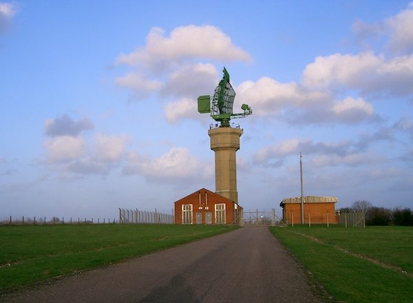
Shielding is the concept used to describe anything that is used to conceal the turbine from being visible to the radar. You can find out why it is important for a turbine to remain hidden from radar in a previous post.
Looking for sources of shielding becomes very important when your wind development is marginally visible or marginally hidden to specific radar. We will talk about possible sources of shielding later on.
How does radar shielding work?
It works on the premise that the shielding already exists and therefore already limits the radar’s coverage close to the ground.
The radar signals will reach the shielding first. This then stops or weakens the signals that get reflected off of the spinning turbine blades, and get picked up on the operator’s radar screen display.
Shielding is very effective because it limits the signal from the radar to turbine but it also limits the return signal from turbine to radar as well – making it doubly effective.
What are suitable sources of radar shielding?
Sources of shielding can be natural or man-made. Listed below are the three most common:
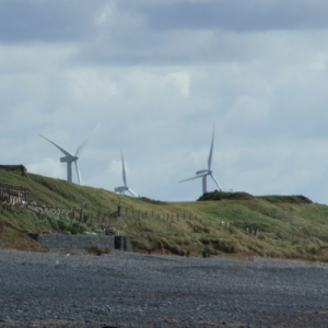
- Terrain
- Buildings (e.g. Hangars, Airport buildings, Housing estates etc.)
- Thick forestry or vegetation
Which is best?
This is something that can be answered by asking yourself “how likely is it to be removed?” The stakeholder needs to be certain that whatever is shielding the turbine from the radar signal will not be removed.
So, taking into account this question as well as the above list, it should come as no surprise that using terrain is best. It isn’t very often that a large hill is flattened out is it? Although it does happen. We once worked on a wind project where the shielding terrain was being quarried away.
There are also activities that can raise the terrain elevation, such as land fill sites or mine spoil heaps.
By first questioning how likely it is that the source would be removed, it becomes obvious why a small area of thick forest/ vegetation would be least desirable. However, radar signals are weakened by vegetation. In a paper titled Radar Propagation at Low Altitudes, author M.L. Meeks writes that “Trees thick enough to block vision are essentially opaque…” And we have previously worked on projects where thick vegetation has been used. A rule of thumb is that if you can’t see through it, then it is likely to block radar signals.
How can I find potential sources of radar shielding?
By far the most useful tool for locating areas to look for useful shielding is a Radar Line of Sight Assessment (sometimes also known as a profile chart).
The formatting of these charts differs depending on the provider, but it is always incredibly useful to have one that shows the terrain profile plot. It enables you to identify any areas where the modelled radar beam might touch the ground (called a blocking point), or is close to it. These areas are where you should be looking for potential sources of shielding.
It is worth remembering that some analysis may use data that accounts for buildings etc. in the terrain profile. Some may not. Our online Radar Line of Sight Assessment falls into the latter category for UK projects and surface data for international ones. We use land data that represents the bare terrain, so as to model the worst case. You will need to understand the type of land data your analysis uses.
Knowing where to look can save the time you spend looking for suitable sources of shielding using maps and satellite imagery.
The height factor
Imagine that you have found a potentially suitable source of shielding, based on the criteria above. You now have to consider another factor; the height.
By far, the most accurate way to learn the height of shielding is to physically survey it. This requires the use of specialist equipment, and travelling to the location. Once the height is known it can be incorporated into further modelling to determine how much radar shielding it will offer. With any luck the results will show that the turbine will be completely hidden.
Need some help?
Even though the concept of shielding a turbine seems relatively simple, putting it into practice can be confusing. We can help you with any stage of finding suitable shielding sources, and modelling how effective they will be. As previously mentioned, we offer a Radar Line of Sight Assessment tool that can be ordered and paid for from this website. More information can be found here. Also, our consultancy services can be customised to your specific needs, including surveying.
We have worked on 24% of all operational wind farms in the UK, and have built up over 17 years’ experience resolving wind farm radar interference. So why not get in touch with us? We’ll be happy to help.
Email info@pagerpower.co.uk or call +44 (0) 1787 319001.
